Home
Practitioners
Morphology
All Morphological Groups
Centric
Araphid
Eunotioid
Symmetric Biraphid
Monoraphid
Asymmetric Biraphid
Epithemioid
Nitzschioid
Surirelloid
Genera
Species
Glossary
About Us
About
News
Projects
Review Board
Taxon Contributors
Contact Us
What are diatoms?
Search
×
Diatoms of North America
Practitioners
Morphology
Centric
Araphid
Eunotioid
Symmetric Biraphid
Monoraphid
Asymmetric Biraphid
Epithemioid
Nitzschioid
Surirelloid
Genera
Species
Glossary
About Us
News
Projects
Review Board
Taxon Contributors
Contact Us
What are diatoms?
Search taxa, citations, glossary, contributors, and images
Submit
Close search
Return to overview
Images of
Nupela
tenuicephala
(Hust.) Lange-Bert. 1993
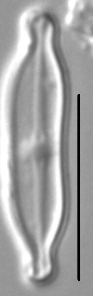
Type Specimen
Slide Number
Montana Diatom Collection 41-39
Site ID
MDC 494201
Site Name
Mexican Cut Pond #12, Gunnison County, CO
Coordinates
39.0294, -107.0650
Scalebar = 10 µm
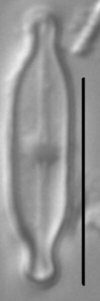
Slide Number
Montana Diatom Collection 41-39
Site ID
MDC 494201
Site Name
Mexican Cut Pond #12, Gunnison County, CO
Coordinates
39.0294, -107.0650
Scalebar = 10 µm
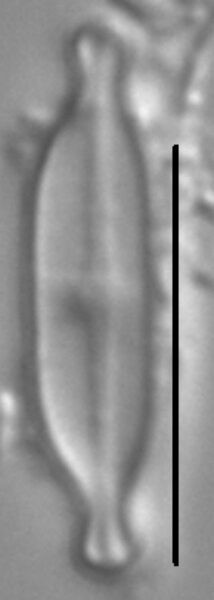
Slide Number
Montana Diatom Collection 41-39
Site ID
MDC 494201
Site Name
Mexican Cut Pond #12, Gunnison County, CO
Coordinates
39.0294, -107.0650
Scalebar = 10 µm
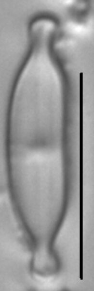
Slide Number
Montana Diatom Collection 41-39
Site ID
MDC 494201
Site Name
Mexican Cut Pond #12, Gunnison County, CO
Coordinates
39.0294, -107.0650
Scalebar = 10 µm
Slide Number
Montana Diatom Collection 41-39
Site ID
MDC 494201
Site Name
Mexican Cut Pond #12, Gunnison County, CO
Coordinates
39.0294, -107.0650
Scalebar = 10 µm
Slide Number
Montana Diatom Collection 41-39
Site ID
MDC 494201
Site Name
Mexican Cut Pond #12, Gunnison County, CO
Coordinates
39.0294, -107.0650
Scalebar = 10 µm
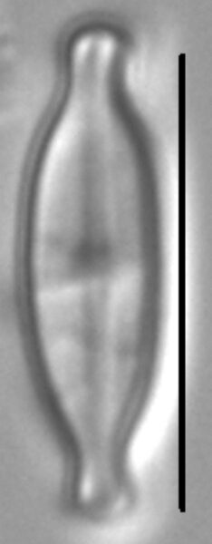
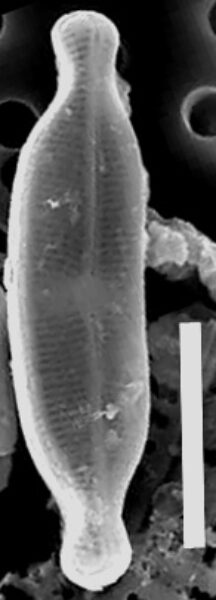
Site ID
MDC 494201
Name
Mexican Cut Pond #12, Gunnison County, CO
Coordinates
39.0294, -107.0650
Caption
SEM, whole valve, internal view
Scalebar = 5 µm
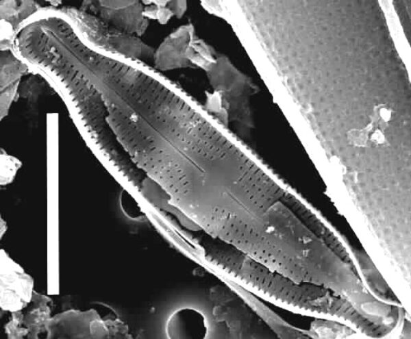
Site ID
MDC 494201
Name
Mexican Cut Pond #12, Gunnison County, CO
Coordinates
39.0294, -107.0650
Caption
SEM, whole valve, external view
Scalebar = 5 µm
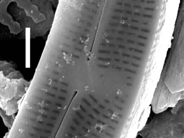
Site ID
MDC 494201
Name
Mexican Cut Pond #12, Gunnison County, CO
Coordinates
39.0294, -107.0650
Caption
SEM, valve end, internal view
Scalebar = 1 µm
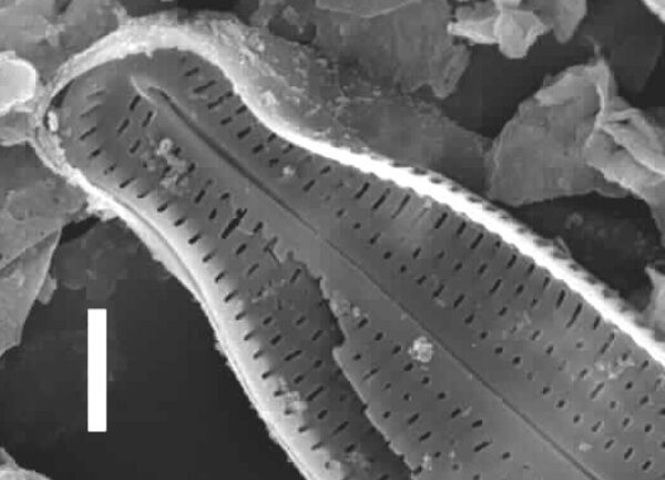
Site ID
MDC 494201
Name
Mexican Cut Pond #12, Gunnison County, CO
Coordinates
39.0294, -107.0650
Caption
SEM, midvalve, external view
Scalebar = 1 µm